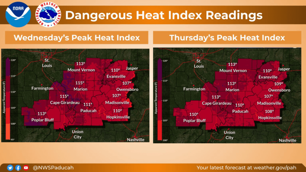
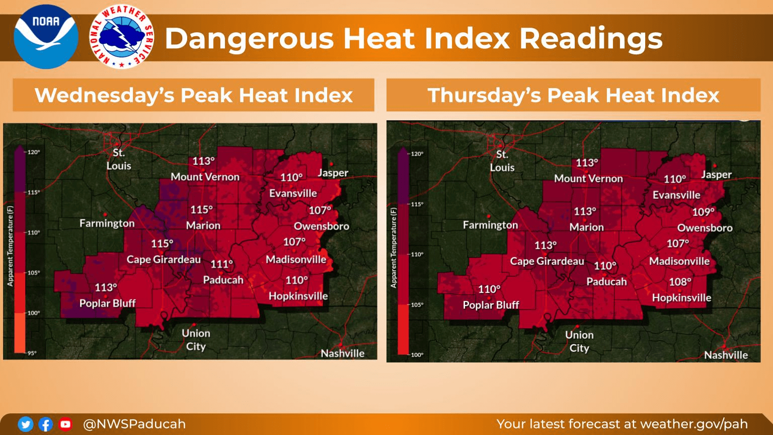
An Excessive Heat Warning for western Kentucky remains in effect through Friday night at 10:00 as dangerously hot conditions could drive the heat index to as high as 114 degrees.
Weather Edge forecaster David Powell said there are several factors that make this a dangerous stretch of days.
click to download audioNot helping matters is the high dew point that hit 81 in Paducah Monday — the highest in nine years and one degree less than the all-time record.
Temperatures this week are expected to be in the mid to upper 90s with heat index readings between 105 and 115 degrees through Friday.
Powell said to take precautions if you are going to be outside this week.
click to download audioYou should drink plenty of fluids this week, stay in an air-conditioned room, stay out of the sun, and check up on relatives and neighbors. Young children and pets should never be left unattended in vehicles under any circumstances.
You should also know the signs and symptoms of heat exhaustion and heat stroke. Wear lightweight and loose-fitting clothing when possible.
A cold front is expected to move through late Friday into Saturday with our extended weather expected to be impacted by instability in the Gulf of Mexico.
click to download audioTropical Storm Harold made landfall in southern Texas Tuesday morning, becoming the first to come ashore in the United States during the current Atlantic hurricane season.