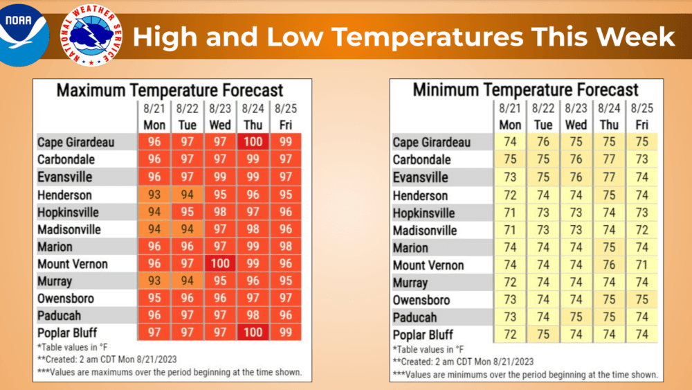
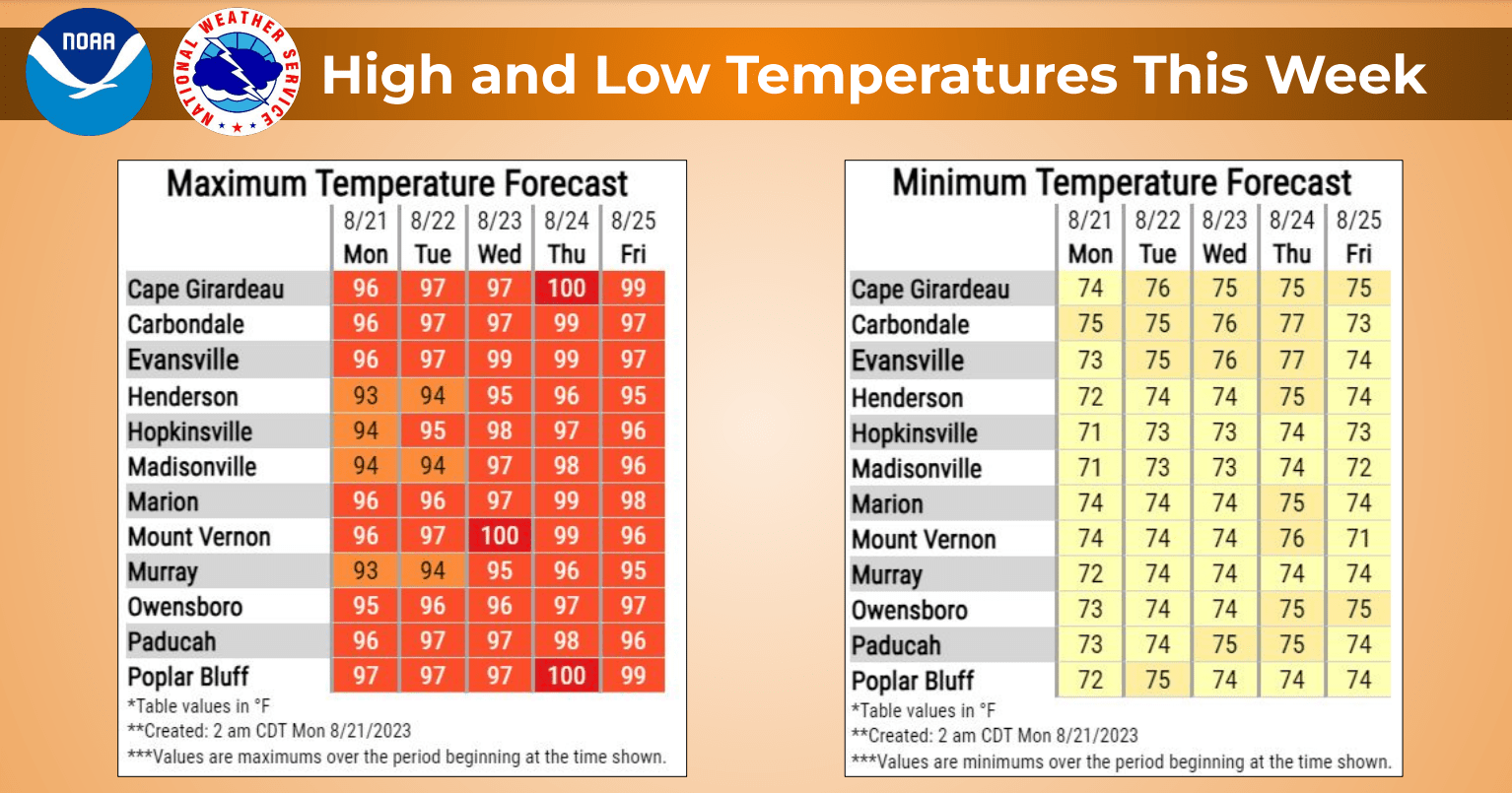
Dangerous heat and humidity will remain across western Kentucky this week with the National Weather Service issuing an Excessive Heat Warning through at least Thursday.
Forecaster Rachel Trevino with the Paducah Office said high temperatures will be in the upper 90s this week with heat index readings between 105 and 110. She said that may cause the heat warning to be extended into Friday.
click to download audioTrevino said people need to take heed of this warning and limit any outside activities.
click to download audioOvernight temperatures are expected to be in the low 70s throughout the week. Trevino said things should start to cool down Friday night although rain is not in the forecast.
click to download audioShe went on to say temperatures should make a return to more seasonable levels next week.
click to download audioNational Weather Service records indicate this week may be the hottest August weather since 2007 when the high temperature topped 100 degrees 11 straight days from August 15-25, including a record high of 109 degrees on August 17 of that year. All total, the high temperature topped 100 degrees for 21 days in August of 2017.
The last time the Hopkinsville office of the national weather service recorded back-to-back 100-degree days was July 25-26, 2012. The last time it happened in August was August 10-14 in 2010.