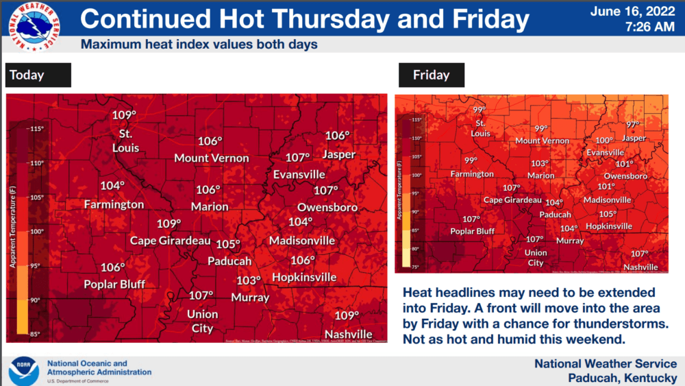
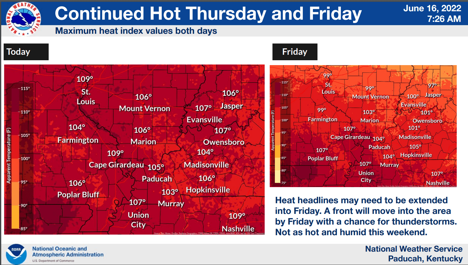
The National Weather Service continued its excessive heat warning for the area until 8 pm Thursday night as temperatures remained in the mid-90s with heat index values over 100 degrees for a fourth straight day.
Dew points will linger in the lower 70s which means the heat index will again rise into the 100-110 range.
Weather Edge forecaster David Powell says we will get a brief break from the heat and humidity this weekend as high pressure over the Great Lakes region provides more seasonable conditions.
click to download audioLight winds on Saturday will allow for dewpoints to fall into the 50s with drier air. High temperatures will be in the upper 80s to near 90 degrees with lows in the lower 60s.
Heading into Monday, Powell says the heat and humidity will be quick to return with high temps once again near 100 degrees from Monday through Wednesday with lows in the 70s.
click to download audioPowell says we could get a respite from the hot weather in the latter part of next week.
click to download audioIn addition to the hot weather, rainfall for the month is tracking below normal with only two days in June providing any measurable rainfall. However, rainfall for the year is still around five inches above normal.