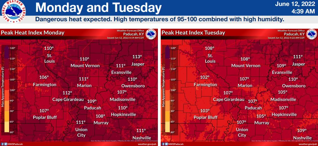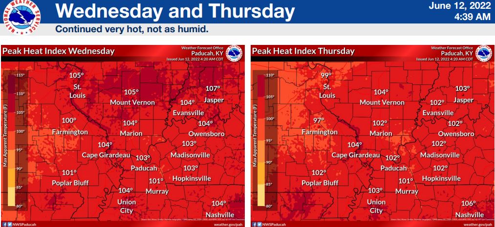

According to the National Weather Service, a dangerous heat wave begins today and is expected to last well into late Thursday before some slightly cooler temperatures return during Father’s Day weekend.
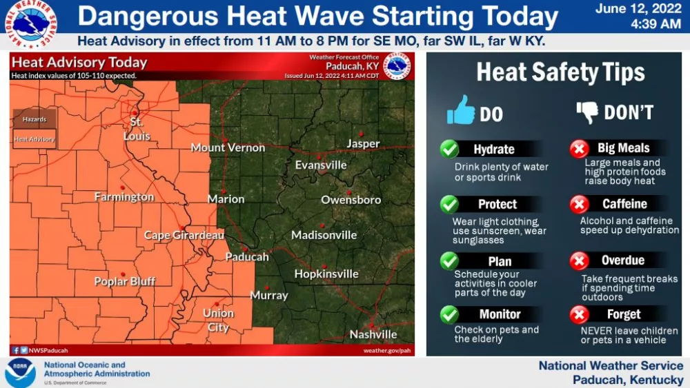
Today, a heat advisory will remain in effect from 11 until 8 in far western Kentucky and along the Mississippi River, as heat index values between 105-110 are expected. Most of western Kentucky also lies in a low-confidence and slight-risk area for severe weather that could potentially develop this afternoon, with large hail, damaging winds and brief tornadoes possible.
The confidence is low, however, because the National Weather Service expects a strong cap to build over the region — which will limit moisture potential. If storms develop, it will be in spite of this.
As temperatures escalate this week, one must be prepared for heat safety measures — and understand the symptoms of heat exhaustion or heat stroke. Dizziness, excessive sweating, clammy skin, nausea and vomiting, a rapid weak pulse and muscle cramps are all signs that someone is succumbing to heat exhaustion. Heat stroke is far more severe, and is often diagnosed following throbbing headaches, no sweating, a body temperature of 103 degrees, a red hot dry skin, excessive nausea and vomiting, a rapid strong pulse and loss of consciousness.
If one must be outside throughout this week, spend considerable time in cooler conditions, drink plenty of water, take cool showers if overheated, wear light and reflective materials and use frequent breaks in activities.