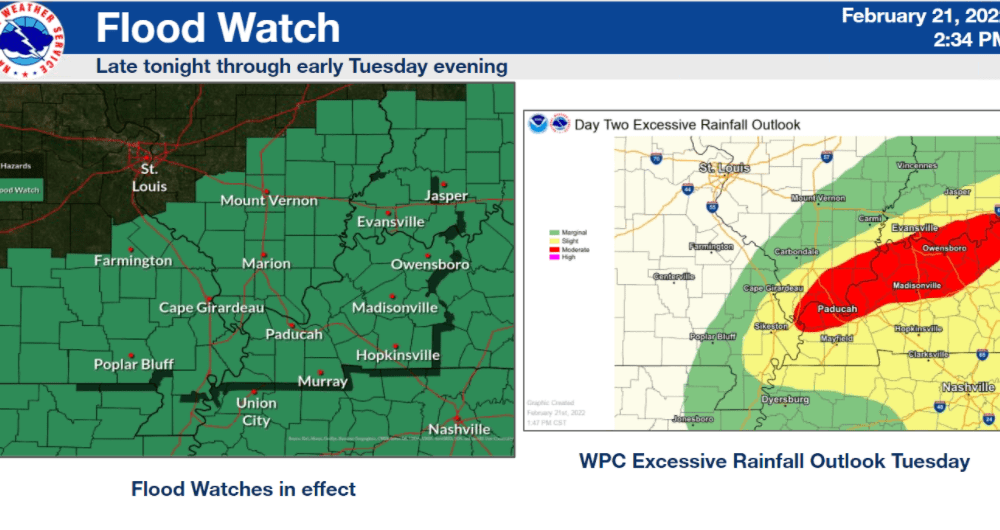
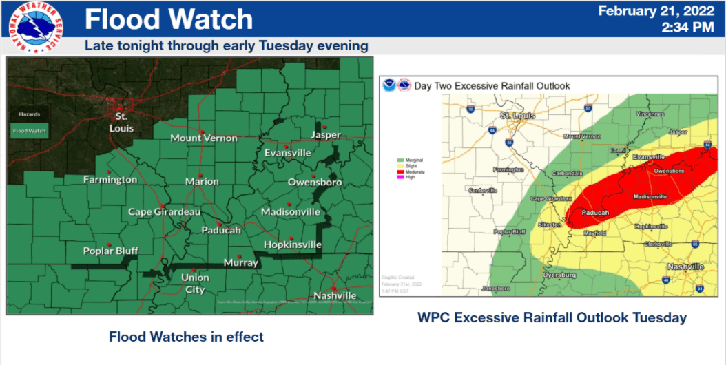
The National Weather Service of Paducah remains concerned about the potential for significant multiple impacts from multiple fronts expected to sweep through west Kentucky and the WeatherEdge listening area over the next 72 hours.
Among the top threats include considerable flash flooding beginning Monday night and rolling through Tuesday, a minor chance for severe storms late Monday night and all through Tuesday — and two waves of freezing rain that could affect travel in and around the Ohio and Mississippi rivers.
NWS Lead Forecaster Chris Noles noted that by the end of Thursday, most of west Kentucky will have received more than 4-to-6 inches of rain.
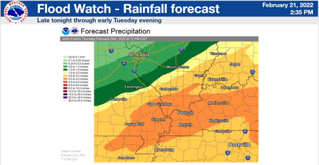
Noles said heavy rains and flooding could begin as early as midnight Monday, with the front pushing through the southeast Missouri bootheel from 3-6 AM Tuesday, and into west Kentucky thereafter — with rains slowing just before lunchtime.
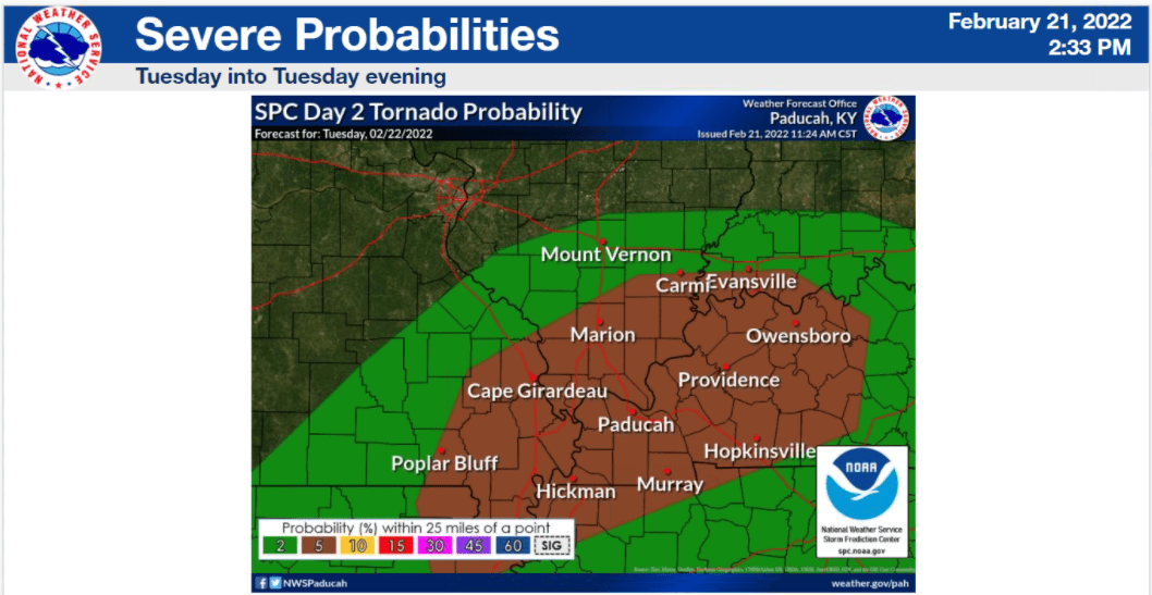
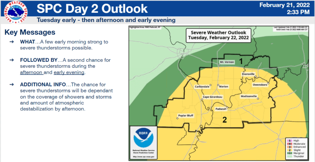
Alongside a flood watch from midnight Monday until midnight Tuesday comes a 5% probability for tornadic activity in west Kentucky, as Noles said instability has increased some from earlier storm models.
Another round of scattered, severe storms remains possible later Tuesday — in what Noles called a “strong cold front” arriving behind this first storm.
Most of west Kentucky received no less than 3 inches of rain in the last week, meaning the ground is extremely saturated near low-lying areas, creeks and rivers. Some of these areas haven’t even had time to recede — much less fully dry — and this brings the flooding concern.
The possibility of flooding in west Kentucky remains into late Wednesday and early Thursday, too, as round two of these storms comes with 1-to-2 inches of precipitation and much lower temperatures. Noles said most of west Kentucky should remain above freezing — but near and above the Ohio River is expected to potentially receive 1/4-inch of ice.
Noles called this week’s weather “a mess,” and said the mix of heavy rains, high winds and pop-up storms could bring down more trees in west Kentucky.
The National Weather Service is expecting to hold another conference call Wednesday, between the first storm event and the expected winter weather in the area.