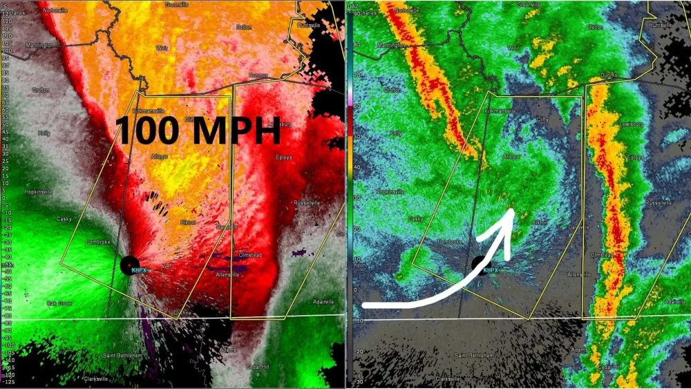
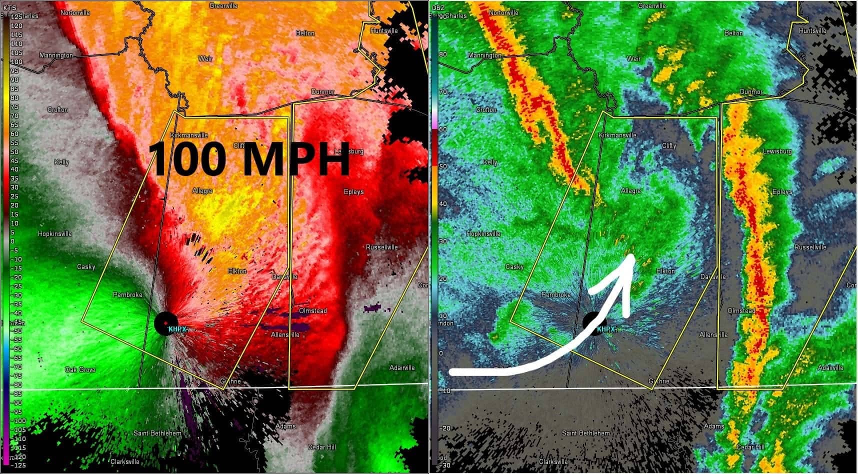
Much of the area suffered downed trees, property damage, and power outages when a storm system moved through the area Saturday afternoon.
Weather Edge Forecaster David Powell says the winds did as much damage as a tornado would do.
Powell says the storm was the remanents of tropical disturbance Olga that moved into the gulf.
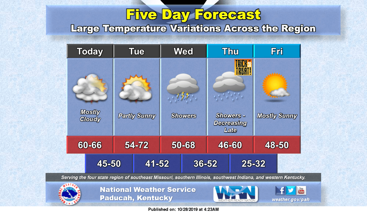
Powell says there will be some major weather changes beginning at early as Wednesday.
After that system moves through, Powell says we will see clearing skies but cooler temperatures.
Get the latest weather by following Your Weather Edge on Facebook.