After much research, I have finally come up with a general idea of what may be expected for the coming winter. Until recently, it hasn’t felt like fall in western Kentucky over the last few weeks.
A large reason for that was the very warm Gulf of Mexico waters and the hyperactive hurricane season. Due to the prolonged warmth, discussion has now turned to what type of weather we can expect this  winter. And the answer from the Climate Prediction Center says our seasonal outlook is a “La Niña.” This is due to a temperature change in the Pacific Ocean that can affect the severity of the upcoming winter. As many of you know, a La Niña is the opposite of an El Niño.
The National Oceanic and Atmospheric Administration (NOAA) says the latter term is used to describe an extended period of abnormally warm water pooled up around the equator in the eastern Pacific Ocean. A La Niña occurs when the same area of the eastern Pacific Ocean is abnormally cool for a number of months. This affects the weather in the U.S. and around the world, especially in the fall and winter months. But there is much more to our weather than just the La Nina. There are things like the blocking patterns, the position of the northern and southern jet streams, the snow pack over the northern areas, and sunspot activity. This year it seems wherever I look the great “drivers” of the weather are doing something unique and unusual which will make creating the winter 17/18 outlook very challenging.
Things just don’t seem to be acting normal. As I write this, there are no sunspots on the visible portion of the Sun, and solar activity is very quiet. This traditionally means a cooling influence on the earth. So why isn’t it colder than average? As I said, other weather factors are at play. One of the most significant relationships we 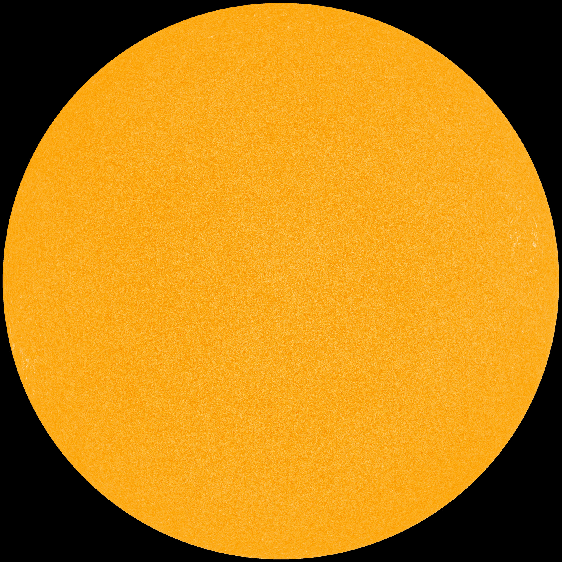 have found is that periods of low solar activity are associated with colder temperatures, averaged across Earth.
Another factor is that the Siberian snow cover has increased massively across eastern Siberia during the past week. Looking back through NIC archive we can see that Russian/Siberian snow cover is currently ahead of all other years except for 2002, 2013 and 2015 going right back to 1998. The snow cover in Canada is increasing as well which will play a role in the intensity of cold air buildup over those areas. So instead of concentrating on the whys and how’s of the coming winter, let’s see what may be coming. First, it looks like a ridge will eventually set up in the western U.S. which will mean a warmer than usual winter for the most part for them. At some point, blocking over Newfoundland will force the Northern jet stream to the south in the eastern U.S. At the same time, the influence of the La Nina will cause the southern storm track to be positioned from around Texas, northeast into southern New England then off the coast. The area where the two jet streams come close together is where the action will be. These jet streams will move north or south and when the cold behind the northern stream is south of our region, snow can be expected. Depending on how far north or south the cold air is will determine if we get  rain, snow, or the dreaded ice.
Based on the pattern we’re seeing right now I would expect the possibility of one or two ice storms this winter, probably before January and mainly from the Tennessee Valley back into northeastern Texas. Western Kentucky may be in danger as well. Overall, the implication is there would be a fast start to winter that hits and holds. October ends on a cold note with occasional rain and possibly a few snowflakes especially to end the month. There very well may be a big storm on or around the 29th as tropical moisture interacts with an incoming storm system. Heavy rains, maybe even severe weather could be a concern. Everything could end with a few snowflakes as colder air comes in behind it. The first two weeks of November should have more clouds  than sun with highs in the lower 60’s.
Temperatures will grow progressively colder by the 3rd week and a storm arrives by the weekend after Thanksgiving. That storm may bring rain, sleet, and/or snow depending on the temperatures. December looks to start off during the first week with a bit of a wintry mix around the 3rd or 4th. Highs for the month will average in the 40’s. The time to watch will be the 23rd, Christmas Eve and Christmas Day. Indications are that a storm will arrive and will likely start as rain on the 23rd but change to either ice or snow as temperatures drop into the low 20’s at night for Christmas Eve.
Another chance of snow comes on New Year’s Eve. January is expected to be cold with snow chances during the second week. By the 14th, the normal January thaw takes place when highs rise into the 50’s. Winter quickly returns with several rounds of snow during the last two weeks. An active storm track will deliver above-normal precipitation to the Southeast, Northeast and New England states throughout most of the winter, especially February. Several sources are flagging mid-February as a time to watch for a significant storm. With very cold air in place, this would be in the form of snow for our region. March will probably be a little slow to warm and snow chances will exist into the first or second week before spring finally arrives. Feel free to leave comments and be sure to hit the “Like” button at the bottom of this post.