The National Weather Service has issued a unique forecast surrounding the rest of the weekend, in which most of Kentucky could experience two rounds of severe weather.
The first round is projected for late Saturday night, beginning around midnight, and rolling into early Sunday morning.
The second round is projected for mid-Sunday and rolling into the early afternoon.
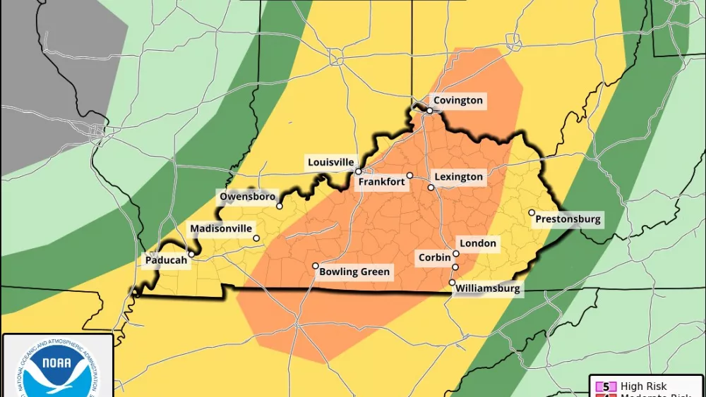
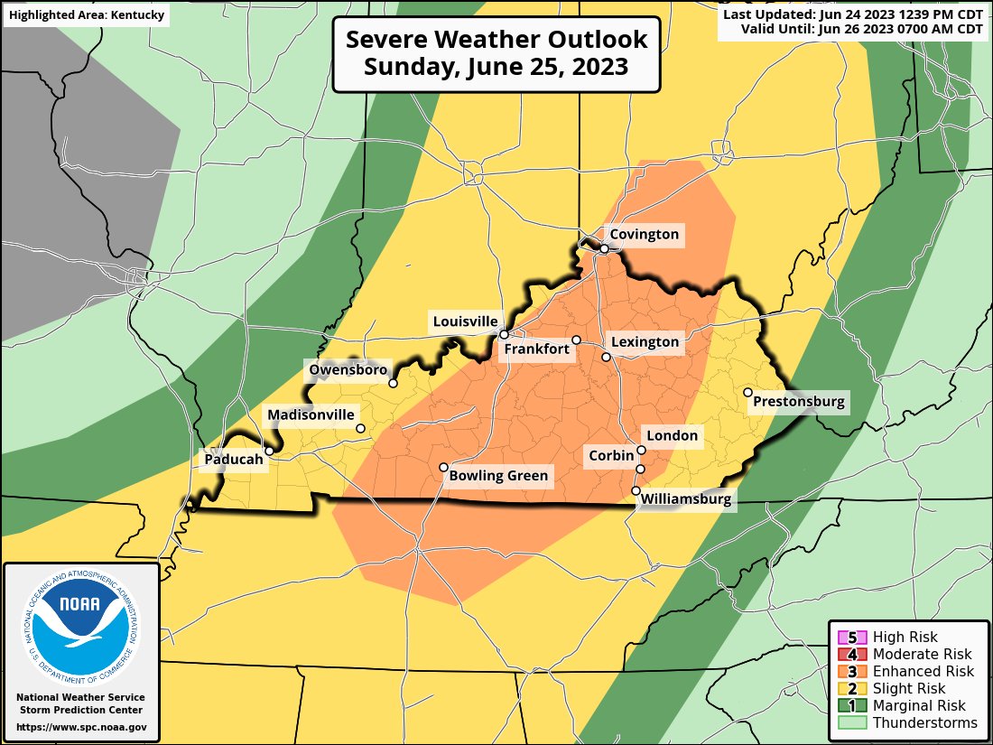
Should storms develop, the eastern part of Trigg County and onward has been placed in an enhanced risk for damaging winds, heavy rains and a 5-to-9% possibility for brief tornadoes along what could be developing fronts.
Officials with the NWS indicate that linear organization is “increasingly likely” for the first front, and that there is a chance the second front forms more from southern Indiana and then pushes across central and southern Kentucky.
Currently and as of 4 PM Saturday, there’s a 40% chance of showers and thunderstorms mainly after 3 AM Saturday night. Increasing clouds, with a low around 69.
On Sunday, showers and thunderstorms likely, mainly before 4 PM. Large hail. Partly sunny, with a high near 93. Southwest wind 8 to 13 mph, with gusts as high as 18 mph. Chance of precipitation is 60%.
Heat indices are also expected to be in the triple digits Sunday, from 100 to 105, bringing west Kentucky its first real taste of a sweltering summer.