Even after a dramatic change in temperatures and a little snow this week, the area remained mainly free from frost.
Weather Edge forecaster David Powell said the snow Tuesday night and cloud cover Wednesday night prevented most of the frost from forming.
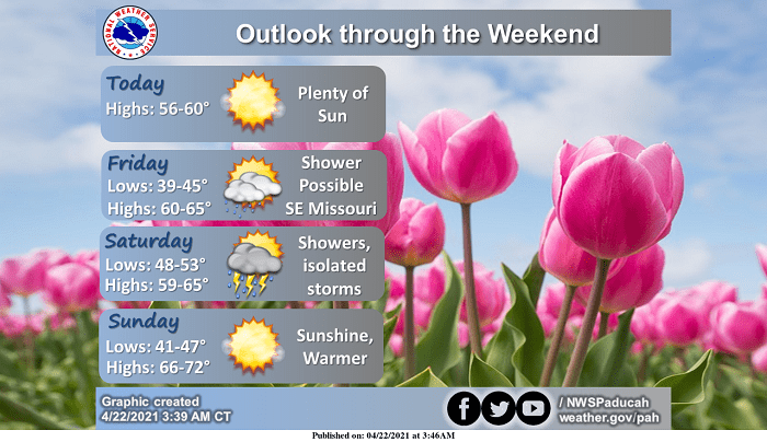
There is a chance for rain and thunderstorms Friday night and through the day Saturday. No severe weather is expected with that event.
As we head into next week, Powell added we might see highs approaching 90.
After a cold front moves through with that possible severe weather around Wednesday, Powell said highs would cool back down into the 60s.