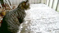
More snow in April?
We are officially knee deep into springtime, but there hasn’t been much sign of the spring weather. Overall, temperatures have been 8 to 10 degrees below normal and the chill of winter just doesn’t seem to want to let go. While we associate April with more traditional spring weather, it can change rapidly from one extreme to another. Temperatures are likely to climb enough in the days ahead to spur on a surge of tree pollen. But unusually wet and rainy conditions will generally hold the pollen count down somewhat.

Following a siege of clouds and moist, chilly air recently, temperatures will climb to near to a little above-average levels on Thursday and Friday in most locations. However, some people may need a jacket and/or an umbrella due to rain. During Easter weekend, the first of several waves of chilly air will sweep from the Upper Midwest. The pattern going into April continues to look unsettled. People should expect some sort of shower or rain event roughly every other day.
It is a type of pattern that may make tackling major outdoor projects a challenge but may allow some minor or quick tasks to be accomplished, especially where and when the rain falls at night, instead of during the daylight hours. Because of the frequent nature of the storms, adjustments on the timing and magnitude of each rain event may vary a few days out. The first full week of April looks downright chilly. In terms of any snow or ice, parts of the region are not done with wintry precipitation just yet.
While accumulating snow is much less likely due to a higher sun angle, there will probably be a small number of storms that may produce at least some wet snow. This up and down temperatures with ongoing storm systems coming through every two or three days will continue until about the 15th. After mid-month, I do expect a more pronounced turnaround to more consistent spring temperatures. But even then, there will still be a few cool shots. While warm spells here and there may make you want to get started on your garden, it’s best to hold off. Be careful about putting things in the ground too fast because April could bring some surprises. 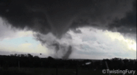
The colder temperatures in March and going into April has held off the severe storm threat. But as warmth begins to build after mid-month, severe weather will waste no time heating up in the Southeast, Gulf Coast and Tennessee Valley, including our area in Dixie Alley. But even after mid-month, there will be more cold snaps. These cold snaps in spring are called “little winters.” If you are outside often enough over time, you’ll notice there are usually four or five of these “Little Winters” in weather patterns that last a two or three days. They were named for the most common bloom at the time, except for “Britches Winter.” That particular cold snap refers to the need to have kept your homespun linen wool long underwear (linsey-woolsey britches) handy. There is a 6th little winter, a phantom winter that some folks call Whippoorwill Winter. I call it “phantom” because it’s not usually as cold or damaging as the rest. Here are the five little winters and when they occur in Kentucky:
- Redbud Winter: early April
- Dogwood Winter: late April
- Locust Winter: early May
- Blackberry Winter: mid-May
- Britches Winter: late May
Severe weather will make a comeback for these regions later in the season, stretching from St. Louis, Missouri, down to Little Rock, Arkansas; Memphis, Tennessee, and eastward into western Kentucky. I do expect our severe season to last well into June this year. So if you can hardly wait for the warmth of springtime…just wait a little longer. Weather is weather and it always changes eventually.