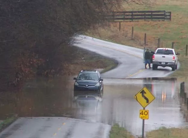
We had lull in the rain today. Heavy rains over the past few days have created some problems, but as of yet nothing serious. However, the National Weather Service in Paducah issued Flood Warnings for Christian and Trigg counties this morning due to South Fork Little River hitting flood stage, but the flood warnings were allowed to expire by mid-afternoon as the river water receded.
Western Kentucky remains under a Flood Watch until 6:00 Sunday morning. During a Facebook Live Conference Thursday afternoon, Pat Spoden with the National Weather Service in Paducah says we can expect three more rounds of rain with the first round beginning tonight.
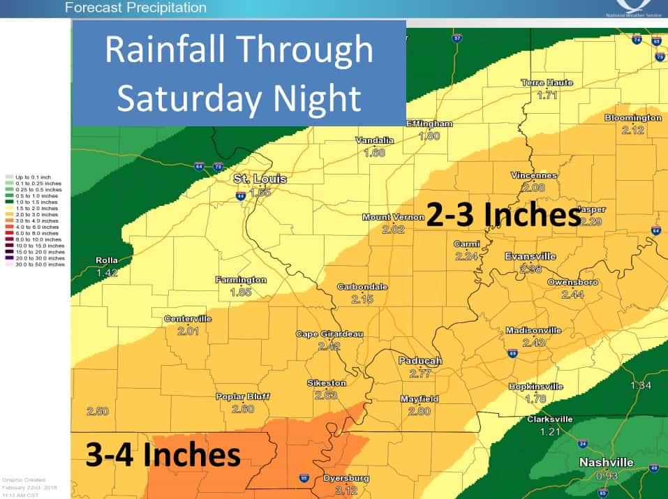
With the forecast of heavy rain, he adds more flash flood warnings will probably be issued the next couple of days.
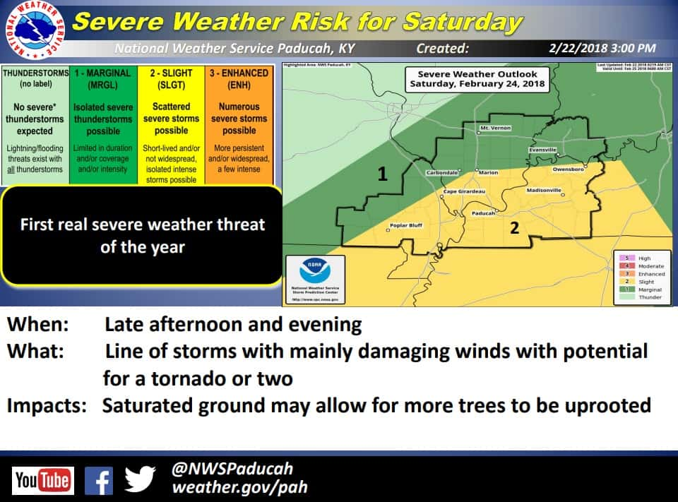
Spoden says the threat of severe weather will move in Saturday, adding this is the first slight risk we have had this year.
The Weather Edge will continue to keep you updated on any flooding or severe weather. You can also find the latest weather by following Weather Edge Forecaster David Powell on our social media pages and at whvoradio or wkdzradio.com.
WebReadyTM Powered by WireReady® NSI