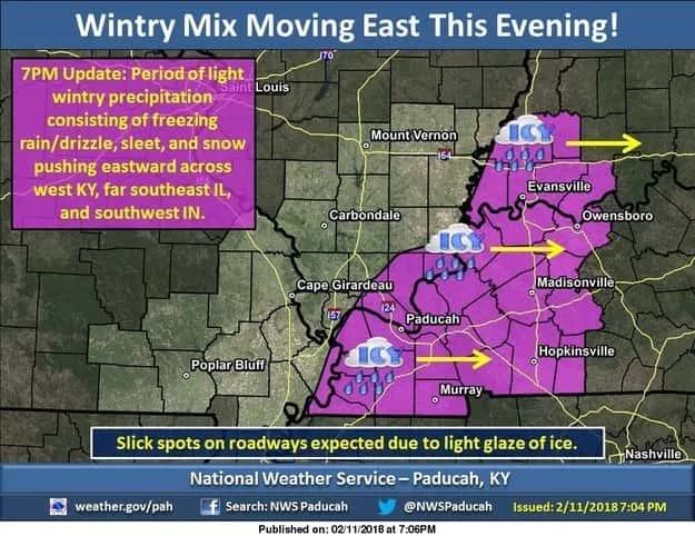
Radar returns are taking shape across southeast Missouri. The National Weather Service says they think there will be a chance of a wintry mix of precipitation that will expand east into west Kentucky as we head into the evening hours.
There is still some uncertainty with this event. Precipitation amounts should remain light if the activity really gets going. However, with temperatures below freezing, any light accumulation could result in the development of slick spots on area roads, bridges and
overpasses, including untreated road surfaces.
We may see all forms of precipitation, including light sleet, light freezing rain and drizzle, and light snow. Should impacts
become more prominent, an upgrade to a Winter Weather Advisory may be required.
WebReadyTM Powered by WireReady® NSI


