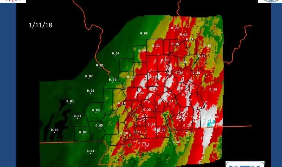

He notes by 3:00 Friday morning all of western Kentucky will have transitioned from rain to freezing rain.

By 6am, Humphrey says everyone is seeing freezing rain, sleet or snow. He adds even a light accumulation of ice with the snow on top can cause major issues.

A Winter Storm Warning is in effect from 9:00 Thursday evening until 9:00 Friday evening. Isolated to scattered power outages and tree damage may occur and traveling will be dangerous, including the morning commute Friday.
In addition, forecasters say you need to be prepared for significant reductions in visibility at times. They add that strong and gusty winds may also increase the hazard to power lines and tree branches weighted by the snow and ice.
A Winter Storm Warning means significant amounts of snow, sleet and ice are expected. This will make travel very hazardous or impossible.
We will continue to monitor the winter storm and bring you the latest information and road conditions.
WebReadyTM Powered by WireReady® NSI